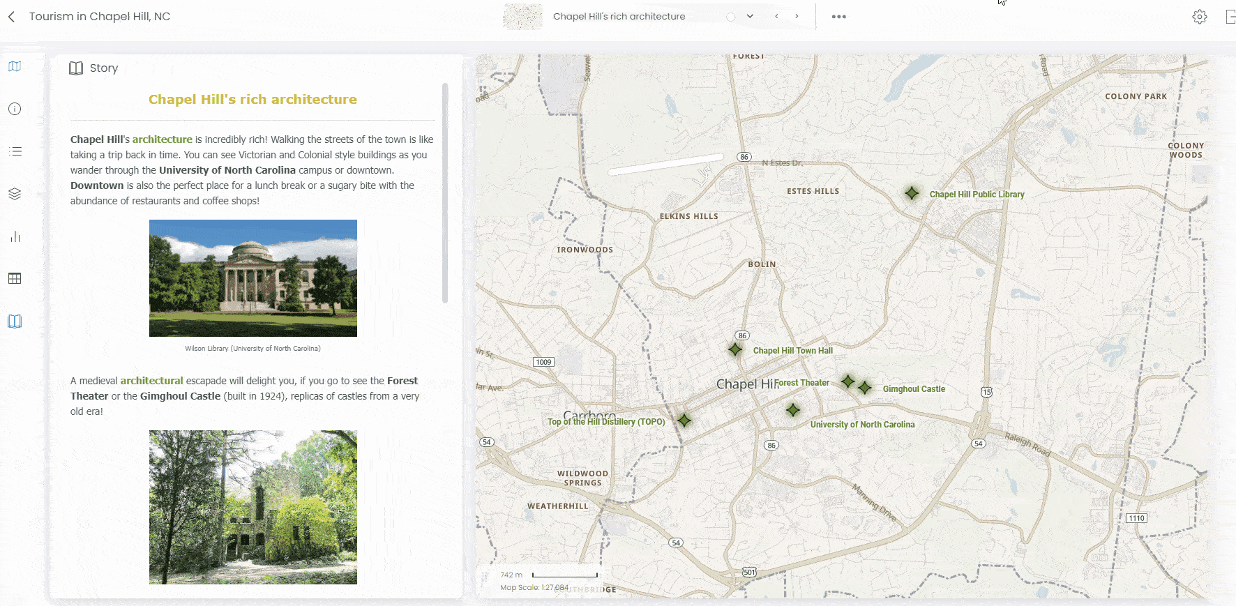
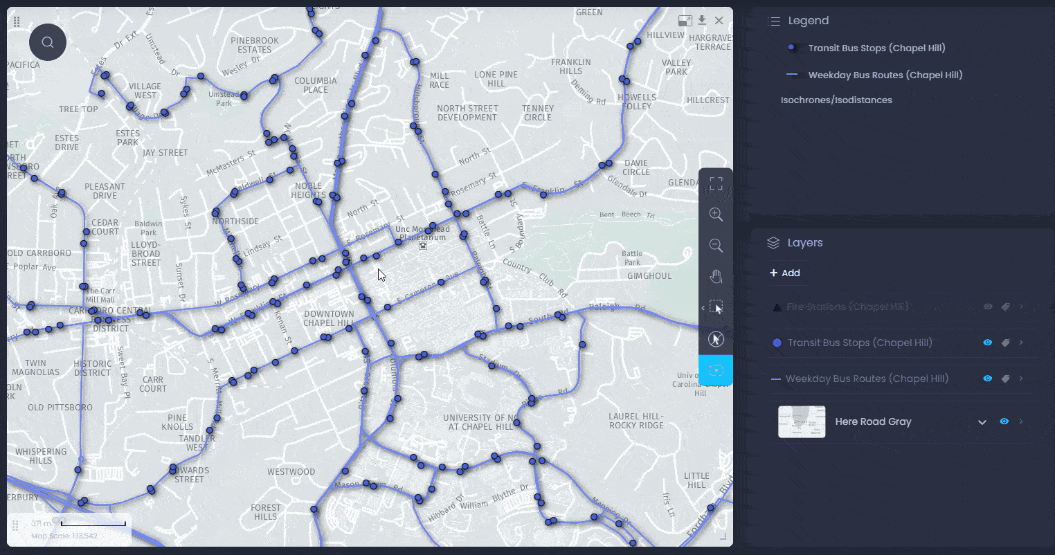
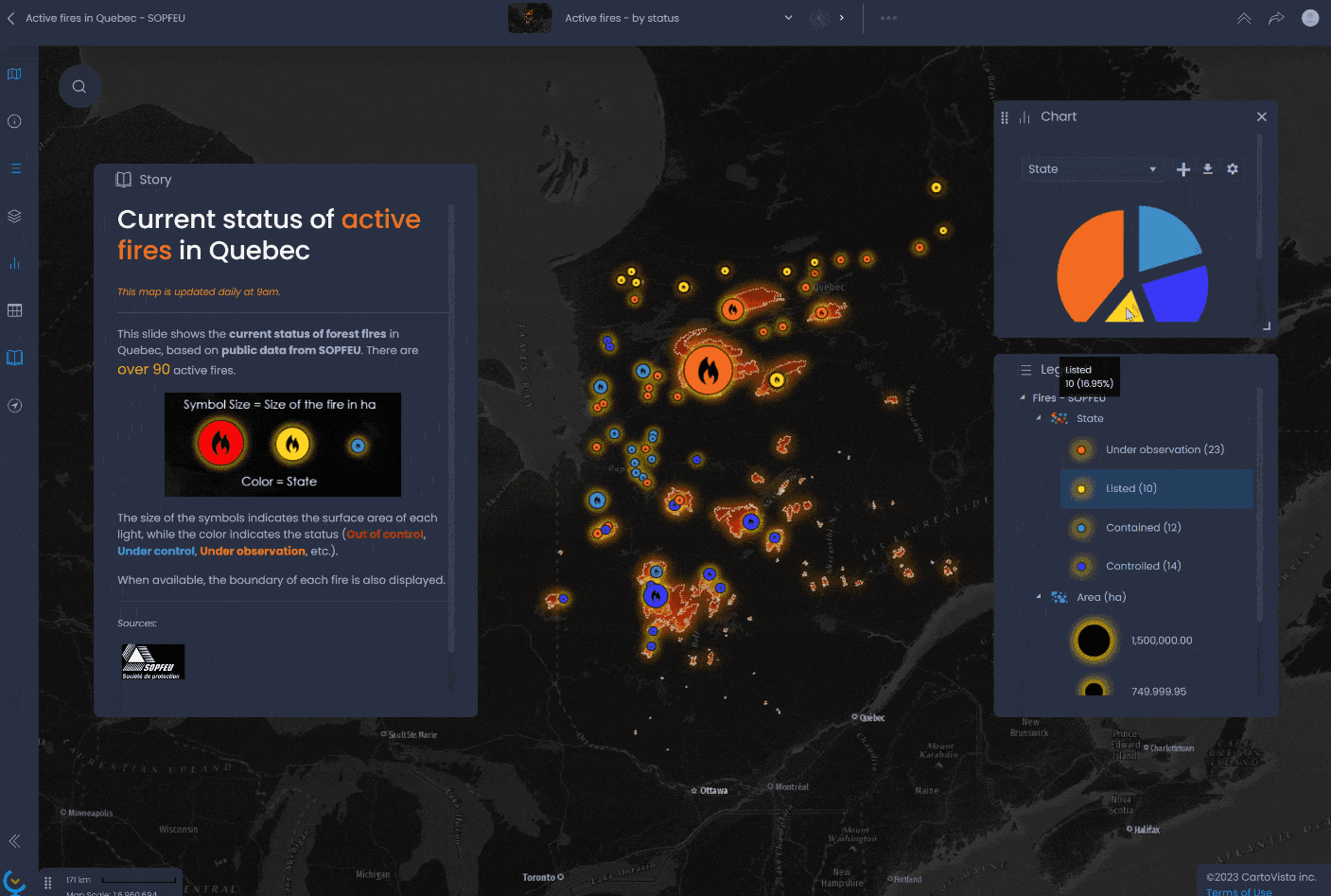
Discover the most efficient web mapping solution for your municipality

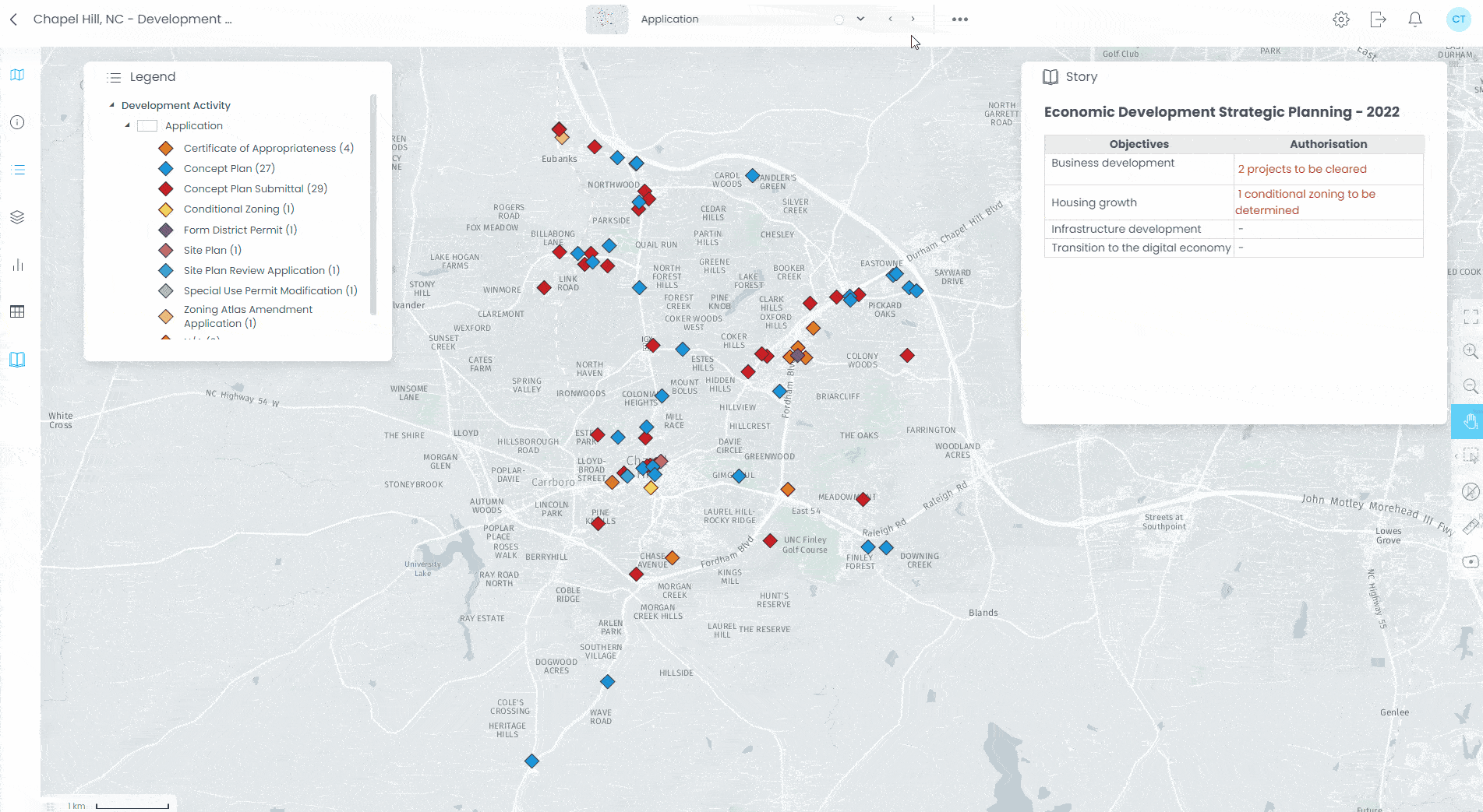
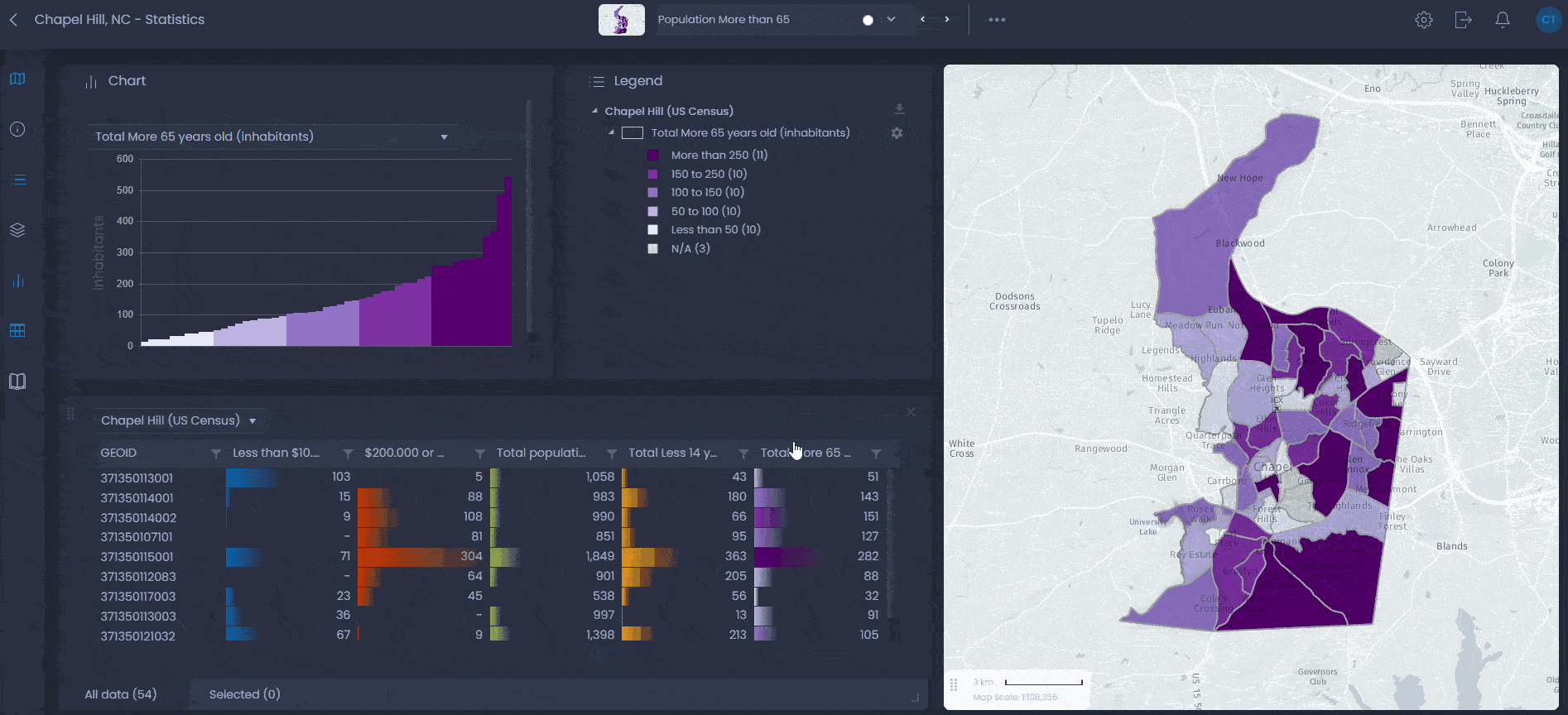
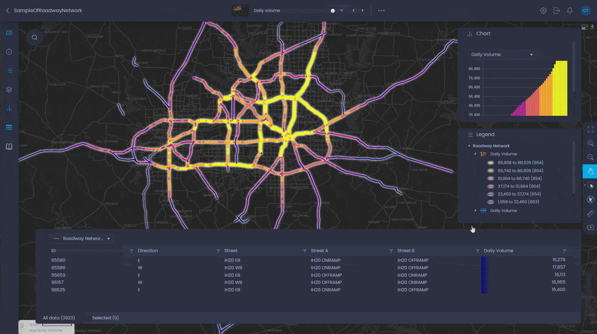
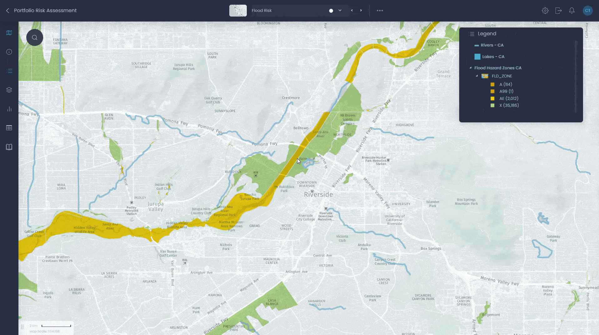
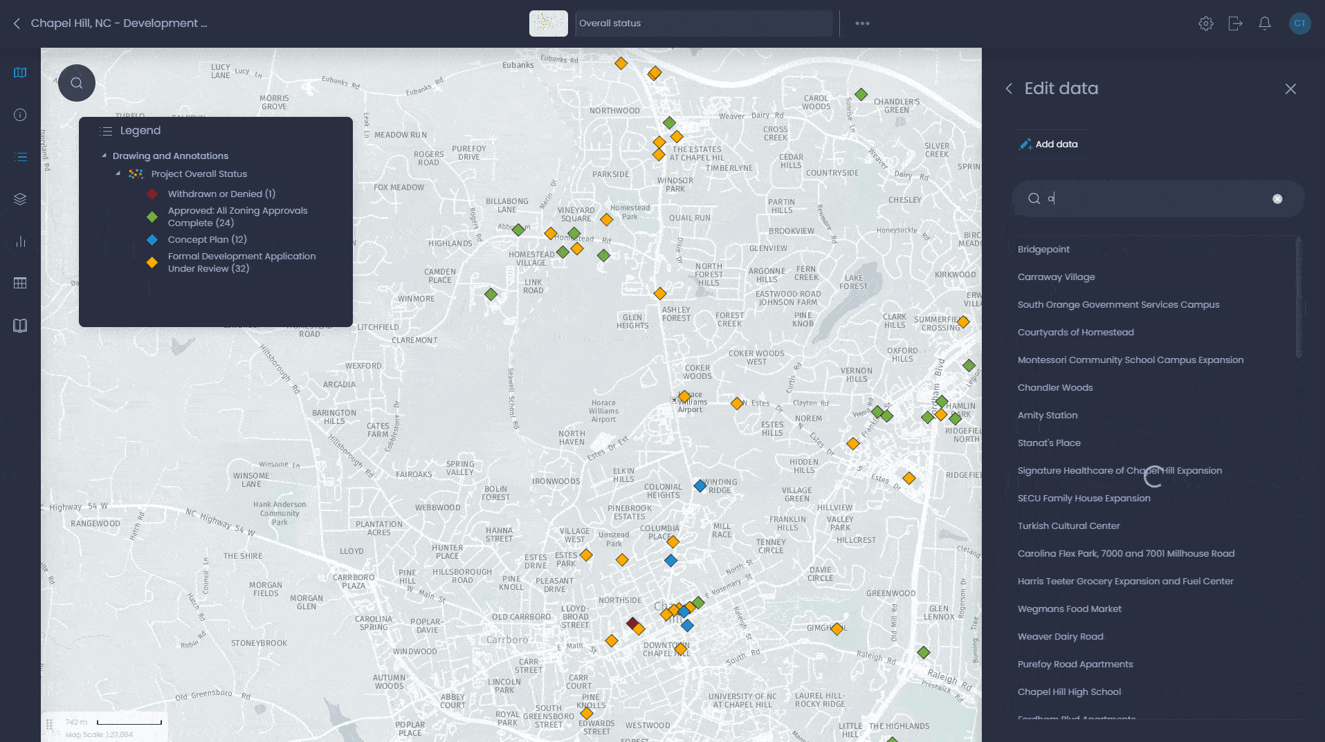
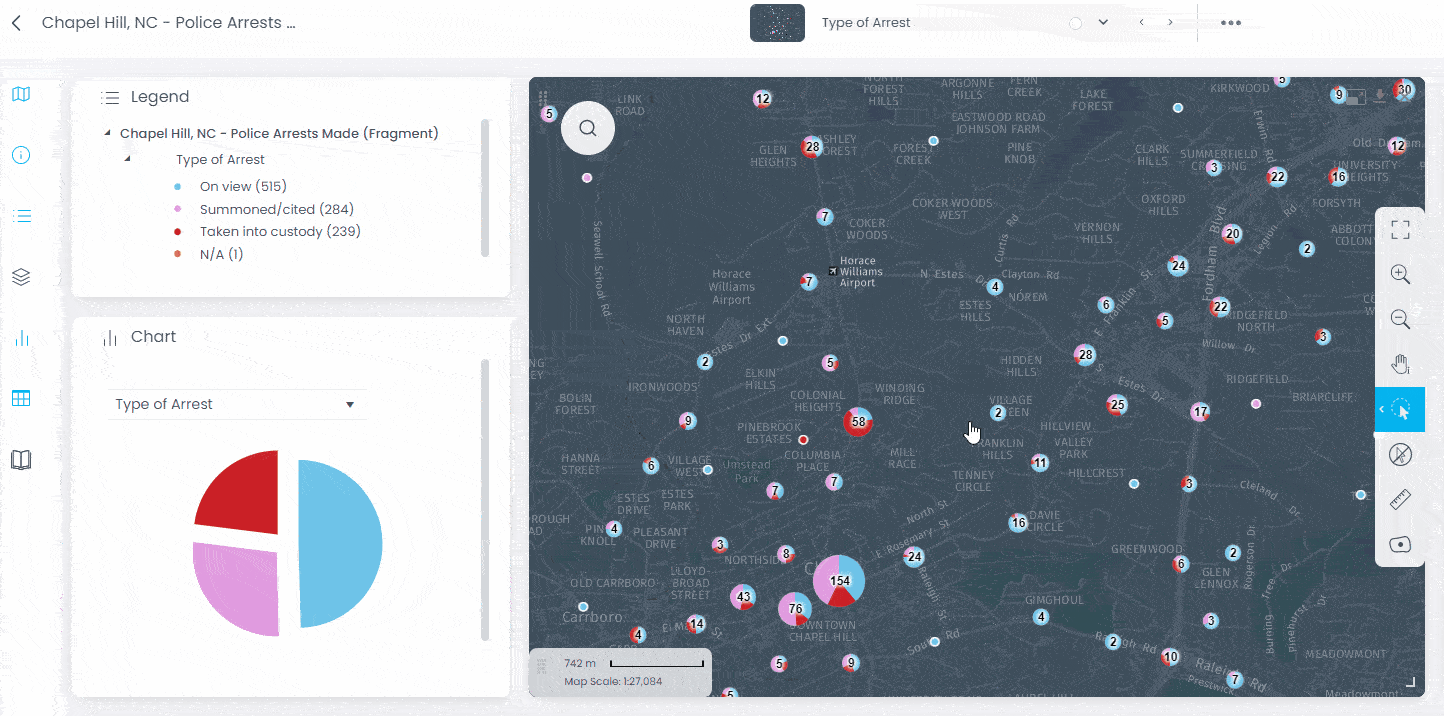
10x your communication: Present your data to city stakeholders more effectively.

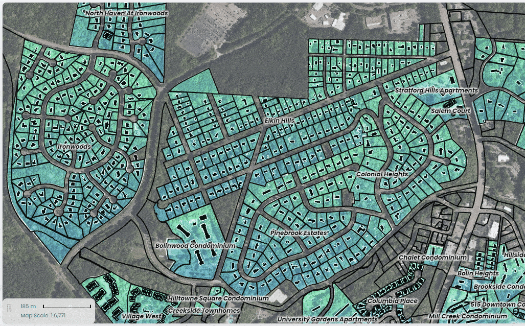
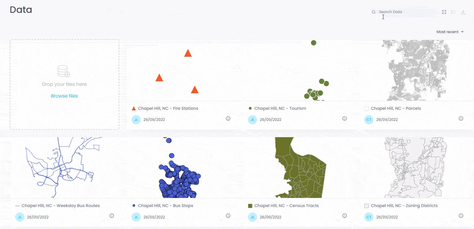
Intuitive interface: Involve your city services and improve collaboration.

Free 14-day trial: Explore CartoVista for free, no credit card required.

Trusted by

Here’s why clients love CartoVista

tutorials

Intuitive interface with little to no learning curve

Enjoy a clutter-free interface that makes it easy to get started, regardless of your technical background. With easy onboarding and great hands-on tutorials to help you every step of the way, you’ll be up and running in no time. Drag & drop your data and visualize it on a map in seconds. Involve your city services by easily sharing your maps & presentations and get them to contribute.

Visualize your municipal data with interactive stories & live data

Integrate Excel, CSV, or more sophisticated GIS datasets, such as ESRI Shapefiles, MapInfo, KML, GeoJSON, and Raster images. Design maps with rich interactions and present data visually with flexible dashboards and engaging stories.

Go further with our REST API and live data stream to make decisions, collaborate, and strategize with the advantage of real-time insights.

municipal data map
esri connect min

Seamlessly integrate with your existing ESRI data

If you already are using ESRI software, CartoVista serves as a powerful addition to your mapping technology stack. You can simply connect to layers in ArcGIS or ArcGIS Online via Feature Services, leveraging the powerful capabilities of both CartoVista and ArcGIS.

CartoVista offers unmatched versatility and a wide array of customization choices for crafting impactful communications via web maps using straightforward story authoring. By merging the capabilities of your existing ESRI data with CartoVista’s distinctive presentation features, you can enjoy the advantages of both platforms simultaneously.

Collaborate more effectively with city services

Cut through the bureaucratic red tape and deliver results faster. CartoVista’s cloud-based platform is designed for self-service and real-time collaboration. Multiple teams across city services and departments can work together effortlessly on data updates and strategic communications.

Live data update

One platform. Endless possibilities.

City counselors

Communication staff

Economic development staff

Planning & Economic Development

Create interactive urban planning council presentations

Citizens

Public

Internal city departments

Online Services

Publish and share land information online (search for parcels, zoning, among other tasks)

Citizens

Public

Businesses

Territory Management

Publish statistics, business directories and create urban observatories online 

Public

Open Data

Publish municipal data (city information, services) in an open data portal

Internal city departments

Public

Smart Cities

Integrate and disseminate connected data online

Communication staff

Internal city departments

Emergencies

Manage hazards—such as floods—and environmental data online

Internal city departments

Data Management

Manage and share city department data online

Internal police department analysts

Police Service

Perform crime data analysis

Communication staff

City tourism staff

Events & Tourism

Create tourism maps, embed publications of events and stories

City transportation department

Mobility Planning

Share data and optimize public transport infrastructure, reduce traffic & improve road safety

Seeing is believing

Transform your municipal GIS data into stunning interactive maps.

CartoVista in action for cities & municipalities

Here’s how MRC des Collines de l'Outaouais in Quebec used CartoVista to improve their data management processes and make more informed decisions for their community.

Play Video about MRC Des Collins Video En

Communicate more effectively with story maps

Whether it’s day-to-day city management or climate emergencies like forest fires and flooding, CartoVista’s Story Maps help you add context to your municipal maps and create narratives to deliver your message more effectively.

Quebec forest fires story map

CartoVista is a unique interactive mapping solution. We deployed our information with extraordinary efficiency and speed. CartoVista allowed us to create more than 8 complete interactive atlases, from socio-demographic and economic statistics to social development, mobility, environment and waste management in a very simple way.

CMQ
Bruno Labonté Geomatics and Information Technology Coordinator

What are you waiting for?
Try CartoVista for free today.